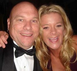
Well we got underway today, finally! Thanks to Terry and Bill, we had the formal name changing ceremony around 11 o’clock last night. This is very important as Neptune needs to be appeased with much libation in the form of champagne poured in precise timing and direction as I gave the water and wind gods our request for good fortune under the boat’s new name: Executive Sweet.
.jpg)
We are about a week late in our departure so to make up for that, we decided (or it was decided for us) that we would take a trip with about a weeks worth of adventure. I gained a lot of experience on today's trip so I will share some lessons learned here.
The Plan
Cast off from home port Mt. Pleasant, SC
Arrive in St. Augustine Florida (around 229 miles, as the boat goes)
Reality
Arose at 0500 to take last minute items to the boat and check the weather. At around 0530 I went in to tell BJ that maybe we should either wait one day, or go down the
IntraCoastal Water Way (ICW). Going through the ICW, or “the ditch" (yes even the acronym has a nickname) is painfully slow and would take about 3 days to get to St. Augustine. Not only that, but it is often narrow with lots of obstacles so if we did the ditch, we would have to wait until the fog lifted. Oh, I did not tell you about that. We woke up to less than ¼ mile visibility due to dense fog. BJ decided she had gotten up early for once so we should not waste that occasion. We cast off at 0615 just in time to get over the shallow hump in front of the house. I did not notice the reduced visibility until we hit the Wando River. There I realized that the fog was as bad as the weather channel had predicted. I just put on the new radar/chart plotter the week before, so I did not really know how to use it efficiently. Plus the radar did not check out properly in the sea trials and the echoes are reading about 0.1 mile closer that they actually are which is better than the other way.
With the fog so thick, I did not want to go in the ICW because it is too difficult to navigate and the radar was not 100% calibrated, so we slowly headed out into the Charleston Harbor using one of my newly added equipment: the fog horn. We cruised out of the harbor at 9 knots and turned south, where I tried to use my recently plotted route and new autopilot. It did not work as I thought it would, but I managed to program the autopilot to go to a waypoint that I marked just outside of St. Augustine, 211 statute miles away. Once we were finally out in the big water and I got used to (trusted) my radar, we went ahead and brought her up to 22 knots heading south. There were 1-2 foot rollers, so it was not that bad.
The fog finally lifted at 1040, but the waves were now running 3-4 feet so the ride got a little uncomfortable for the crew. We learned that Simba is not short for Simbad the sailor. I looked down to the cockpit and told BJ that I thought the dog was seasick because she was kind of foaming at the mouth. Since we were in heavy seas and the sea spray was coming in the cockpit along with the diesel fumes, I figured that Simba would more enjoy the bridge of the boat so BJ carefully coaxed her up in between the sudden rolls and jerks of the boat in the now 4 foot waves. That decision may not have been the best because after about 15 minutes, she left her breakfast in the corner of the helm, although she seemed to feel a little better after that although she shed profusely. I wish I had as much hair as she left behind in the cockpit and bridge area.
It was a long day in really rough seas. At one point I think there were 6 footers and they were stacking up onto each other, which made it very difficult to find any type of trough to steer the boat into. BJ and Simba spent the entire day laying down in the front of the bridge.
Me on the other hand, was learning a new skill; how to find and dodge thunderstorms using the radar. There were several thunderstorms on the way down, and that is particularly significant and the winds around these storms were stronger and they shifted directions often, which make the waves larger and more unpredictable. At this time we had to slow down to 20 knots in an attempt to keep the boat from hitting down too hard. I had no idea what the cabin looked like in these seas. We spent over a week loading it up, and there is a lot of stuff everywhere, I just hoped it was everywhere that we placed it
When we were about 9 miles from the inlet, the fuel gauges read empty, but my fuel log that I had been keeping indicated that I should have had plenty of fuel. I noticed something on the radar, but I could not really see anything because of the glare from the sun glistening off the water. I then saw what looked like a bunch of fish or something jumping out of the water so I slowed down to identify it. When I came off plane, my starboard motor quit and my bilge pumps started to run. I restarted the motor and had BJ steer the boat towards the waypoint. We were in pretty rough seas since a bunch of afternoon thunderstorms had just passed by, so going down into the bilge was not an appealing thought, but I needed to know how much water we were taking on, so down I went. Oh I can’t tell you how great diesel smells when it is hot, noisy and I am trying to balance myself from the 3 foot waves hitting the boat abeam to, and I am leaning over moving parts trying to find the source of the water that is pouring in from the outer stringers. I narrowed it down to a leaky stuffing box from the port side rudder, and it wasn’t leaking enough to stop our travels.
Now that I was back at the helm, I started getting nervous about the fuel gauges reading “E”, so I finished the leg at about 18 knots which gave me the best mileage on plane. At this time, we decided to start calling marinas. We wanted to stay at the municipal marina so we could walk to the historic district of St. Augustine; however they were completely booked for the New Year’s weekend. I tried another marina and there was no answer. So we decided to get fuel at the municipal marina and figure out where to go from there. Just as we cleared the inlet, a massive thunderstorm hit and reduced visibility to next to nothing, so I was driving in a strange port using GPS and uncalibrated radar only. I finally found the marina, passed under the Bridge of Lions and tied up at the fuel dock. The diesel price was $3.63 per gallon and after the reconciliation; I was about 40 gallons off with my crude fuel log so I will have to make some adjustments to how I calculate fuel burn for the future.
While fueling, a man came by and said to try the Conch House Marina since he just cancelled his reservation of his 32 foot boat. It was worth a shot, since all other marinas were booked, and BJ did not really want to anchor off. We had a little luck as it was the cancellation that allowed us to move over to the Conch House Marina on the back side of Anastasia Island. We pulled in the pitch dark and found our slip and a couple of dock hands standing by. We will probably be here for 3 to 4 days due to a cold front coming in with a lot of wind. We need the time to get the boat situated anyways, so we will make good use of our stay and enjoy ringing in the New Year here in St. Augustine.
.jpg)
The Conch House Marina
This is a real nice marina with an extremely helpful staff. There is an on-site restaurant, a little bar, and a motel. The ship’s store is not very well stocked, but there is a West Marine store less than a $10.00 cab ride away. There are fuel docks here, but I already fueled up so I did not look at the prices.
.jpg) Well, last night we received our first visitors, albeit it was not really planned. Mac McComb and Brian Steffes (Canada Brian) are on a quick boondoggle to Florida and had no real schedule so they stopped by to see us in Ft. Lauderdale. We had Rock Star parking at the New River downtown marina. We were basically parked at the Riverwalk shopping complex which is also about 2 blocks from the downtown party district and quite close to the Las Olas shopping and eating district. We spent a little too much time at the Coyote Ugly bar after spending too much time the Briney Waterfront, which did not make this morning the most pleasant morning.
Well, last night we received our first visitors, albeit it was not really planned. Mac McComb and Brian Steffes (Canada Brian) are on a quick boondoggle to Florida and had no real schedule so they stopped by to see us in Ft. Lauderdale. We had Rock Star parking at the New River downtown marina. We were basically parked at the Riverwalk shopping complex which is also about 2 blocks from the downtown party district and quite close to the Las Olas shopping and eating district. We spent a little too much time at the Coyote Ugly bar after spending too much time the Briney Waterfront, which did not make this morning the most pleasant morning..jpg) After the fellow continued on with their journey to the Keys (they think), we headed to Peterson’s fuel barge. It is a great concept as the barge holds 10,000 gallons of diesel fuel and can park in any water 20 feet or less, or just tie up to another boat. We took on about 340 gallons which is a far cry less than the 3000 gallons going into the 100+ boat on the other side of the barge.
After the fellow continued on with their journey to the Keys (they think), we headed to Peterson’s fuel barge. It is a great concept as the barge holds 10,000 gallons of diesel fuel and can park in any water 20 feet or less, or just tie up to another boat. We took on about 340 gallons which is a far cry less than the 3000 gallons going into the 100+ boat on the other side of the barge..jpg) We only ran at 18 knots since the boat has been under major stress with the trips we have taken so far. I tightened up every nut, bolt and screw that I could find, and it seemed to keep everything together much better. The seas never laid down so it was a bumpy three hour run to Bimini.
We only ran at 18 knots since the boat has been under major stress with the trips we have taken so far. I tightened up every nut, bolt and screw that I could find, and it seemed to keep everything together much better. The seas never laid down so it was a bumpy three hour run to Bimini..jpg) As we started in between South and North Bimini, the water got smoother and the scene became familiar. We saw Sara’s End of the World bar with the worlds best Lobster pizza; the bar that Stevie S. plays live music after the Compleat Angler burned down; the Customs house and finally the Big Game Marina which is where we are staying. We liked this marina last year because of the location. It used to be the place to be here in Bimini until a new resort went up at the very north end of North Bimini. It is really nice with great docks and facilities, but a little “yachty” and as far as you can get from the End of the World (bar that is).
As we started in between South and North Bimini, the water got smoother and the scene became familiar. We saw Sara’s End of the World bar with the worlds best Lobster pizza; the bar that Stevie S. plays live music after the Compleat Angler burned down; the Customs house and finally the Big Game Marina which is where we are staying. We liked this marina last year because of the location. It used to be the place to be here in Bimini until a new resort went up at the very north end of North Bimini. It is really nice with great docks and facilities, but a little “yachty” and as far as you can get from the End of the World (bar that is).